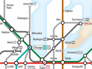
I loved this the moment I read the title: Interstates as Subway Diagram. Designer Cameron Booth crafted this map of the Eisenhower Interstate System in the style of a subway map, emphasizing connections rather than literal geography.
If you’re planning a drive from Los Angeles to Denver, for example, the route is obvious: I-10 to I-15 to I-70.
In the era of Google Maps we can obsess over the literal geography of a trip in a way never before possible, even previewing an entire cross-country trip in Street View before ever getting into the car. But on the Interstates, you’re in a world of exits and interchanges where the geographical details of when the road ascends a hill or veers north are wholly irrelevant.
This map embraces that spirit, and is a work of art in its own right.
Booth sells posters of the map (36 by 24 inches) for $49 with shipping, as well as a similar diagram of numbered US Highways. His Flickr feed includes some other transit-themed diagrams (e.g., the TGV routes in France or Europe’s E-Road network) along with more than a little photography.
(via Lifehacker)
